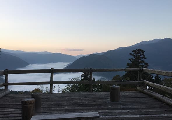
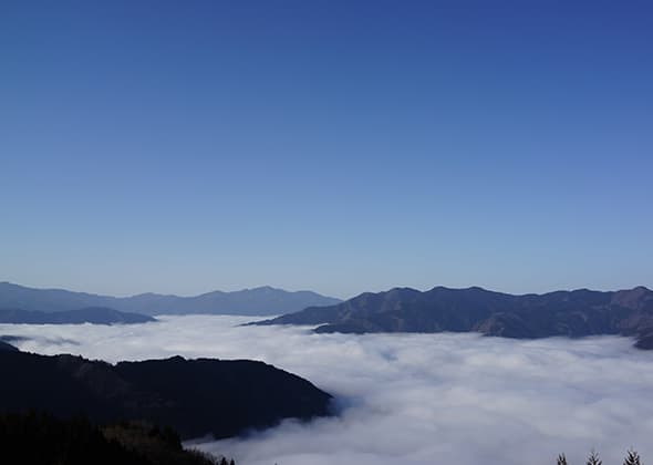
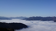
SEA OF CLOUDS COURSE
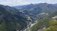
The fog that arises alongside the Yoshino River becomes the sea of clouds of Miyoshi City.
You can look across, enjoy, and photograph the various views of Oboke, Yoshino River, as well as the Kochi prefecture direction.
The time frame in which the sea of clouds can be seen: Sunrise to 7:30AM.
The time of year in which the sea of clouds highly occur: March to April and October to December.
The climatic conditions in which the sea of clouds highly occur: When there is a large temperature difference compared to the previous day as well as a clear sunny sky in the morning of that actual day.
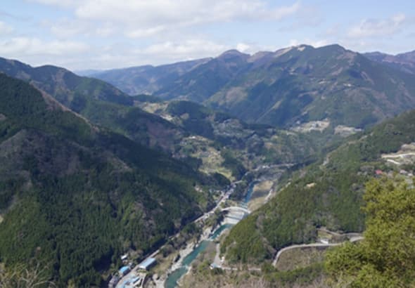

You can look across, enjoy, and photograph the various views of Oboke, Yoshino River, as well as the Kochi prefecture direction.
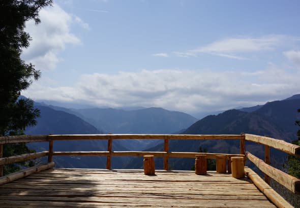
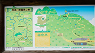
This Outlook was completed in the end of March in 2015. The wood of the cedar trees that previously intercepted the view were utilized to build the 6 meter-wide, 4 meter-long wood deck (altitude 599 meters) of the outlook. In addition, there is a wooden hand rail located 100 meters right before of the outlook and you can look across the view in the direction of Oboke and Nishiiyama.
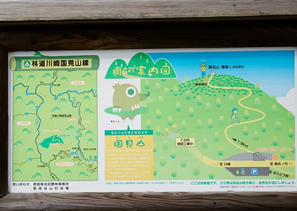
The great outlook overlooking from the Kenzan mountain range to the Ishizuru mountain range is the highlight of Kunimi Mountain!
Kunimiyama (altitude 1,409 meters) mountain is located in between Iya vlley and Obokekyo valley. The view from the outlook is around 360 degrees. The optimal mountain climbing season is from early April to late November. The view in November is especially magnificent.
※It is approximately 1.9 Km (about 50 minutes on foot) from the mountain parking lot to the summit.
※ There is no toilet at the mountain climbing parking lot.
※ The capacity for the mountain climbing parking lot is around 10 passenger cars.

Latest Information
© 2018 City of Miyoshi.